The FWP sample in 2019 was hook and line and found decent sized brookies. Only a few were stunted
| Size: | 25.8 acres |
| Elevation: | 9794.08 ft |
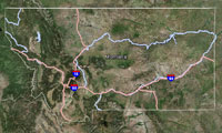
| Directions: | Head of Sodalite Creek. Can easily be reached from fossil and bald Knob Lakes. Seldom Traveled Trail. |
| Status of the Fishery: | |
| Township/Range/Section: | 08S 15E 36 |
| Latitude/Longitude: | 45.0833434075 -109.818478237 |
| FWP Region: | Region 5 |
| County: | |
| Fishing District: | Central |
| Type: | MTNLAKE |

Click on rows to select them for use in other tabs.
| Waterbody | Section | Field Form Type | Date | Purpose | Species |
|---|
To see this data, first select one or more rows from the Collection Info tab.
For Comparative analysis all Length Units are millimeters : all Weights are grams
| Species | Count | Avg | StdDev | Min | Max | AvgWgt | StdDevWgt | MinWeight | S/L | Sects | Surveys | Waterbody |
|---|
To see this data, first select one or more rows from the Collection Info tab.
For Comparative analysis all Length Units are millimeters : all Weights are grams
| Waterbody | Section | Species | Count | AveLength | StdDevLength | MinLength | MaxLength | AveWeight | StdDevWeight | MinWeight | MaxWeight |
|---|
To see this data, first select one or more rows from the Collection Info tab.
For Comparative analysis all Length Units are millimeters : all Weights are grams
| Waterbody | Year | Section | Species | Count | AveLength | StdDevLength | MinLength | MaxLength | AveWeight | StdDevWeight | MinWeight | MaxWeight |
|---|
To see this data, first select one or more rows from the Collection Info tab.
This is a preview, all fields will be visible by selecting a download option. For Comparative analysis all Length Units are millimeters : all Weights are grams.
| Year | Species Abbrv | Length | Weight | M/C | Count | Sex | Mort | Hook Scar | Disease | Scales | Otolith | Fin Clip | Tag | Comment | Genetics | Age | Stomach | Intercept | Slope | Gear | Equipment | Trip | Date | Pass/Run | Water | Section | Lat/Down | Lon/Down | Lat/Up | Lon/Up | Agency | Start Depth | End Depth |
|---|
No fishing pressure information found.
View the latest Montana Fishing Regulations.
No Gauging Stations found.
There is no fish consumption advisory for this waterbody.